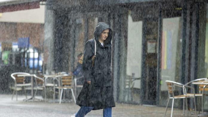
After a week of record-breaking high temperatures in the UK, thunderstorms have surged through various regions, bringing an abrupt conclusion to the recent heatwave experienced by many.
On Sunday, a fresh record was established as the UK experienced its seventh consecutive day of temperatures surpassing 30 degrees Celsius. This remarkable streak, the longest ever recorded for the month of September, came to an end.
However, on Monday morning, early thunderstorms hit southern Scotland, prompting a yellow warning in effect until 6 a.m.
Following this, thunderstorms also occurred in Northern Ireland, northern regions of England, Wales, and northeastern Scotland.
The upcoming week promises cooler temperatures, though some parts of the southeast are expected to enjoy another day of warmth, with London anticipating highs of 27 degrees Celsius today.
Northern parts of England and southern Scotland are projected to experience temperatures in the low 20s, while slightly warmer conditions are anticipated in the Midlands.
Sky News weather producer Chris England says temperatures will “be around the seasonal average” this week.
“Cloud, rain and cooler air spreading from the northwest will bring an end to the hot spell, although the southeast will be quite warm and humid into Tuesday,” he said.
“Thereafter, temperatures will be around the seasonal average, but it’ll be unsettled, with further rain and strong winds moving into the northwest on Wednesday night, then sinking south.
“Central Britain looks like being mostly wet into the weekend, with some heavy rain likely, while gales are possible around north-western coasts. The southeast looks mostly dry after tomorrow.”
Met Office meteorologist Tom Morgan said “a few thunderstorms” can be expected on Monday.
“For the vast majority they will be a bit more scattered in nature than (on Sunday),” he added.
Saturday marked the pinnacle of the heatwave, as temperatures inched just above 33 degrees Celsius at London’s Kew Gardens. Last week, the presence of Saharan dust led to striking sunsets and sunrises in the clear skies.
However, this phenomenon has now yielded to a south-eastward advancing band of rain, ushering in cooler temperatures, especially in the northwest, starting from Monday.
Mr. Morgan described this heatwave as “unprecedented.”
“We have never seen anything as long lived in terms of a heatwave in September before,” he said.
As we move into Tuesday, the majority of the UK should anticipate temperatures that align with the typical September averages. Highs of 18 degrees Celsius are forecasted for northwest England, with the Midlands experiencing slightly higher temperatures.
In contrast, portions of the southeast are expected to maintain temperatures of approximately 23 degrees Celsius, possibly extending into Wednesday.
According to the Met Office, Wednesday should bring a cooler and sunnier outlook for the entire region, but it may become cloudier with westward-advancing rain later in the day, persisting until Friday.
Additional periods of rain are in the forecast for both Thursday and Friday.